Addressing future [glossary_exclude]urban sprawl[/glossary_exclude], as well as the current effects it can have on an environment, is key to tackling the biodiversity crisis. To target [glossary_exclude]urban sprawl[/glossary_exclude] specifically, the Terrascope Class of 2024 outlines a range of solutions, from construction projects to policy recommendations. However, to understand the solutions proposed, the problem at hand must be clearly defined.
The Problem
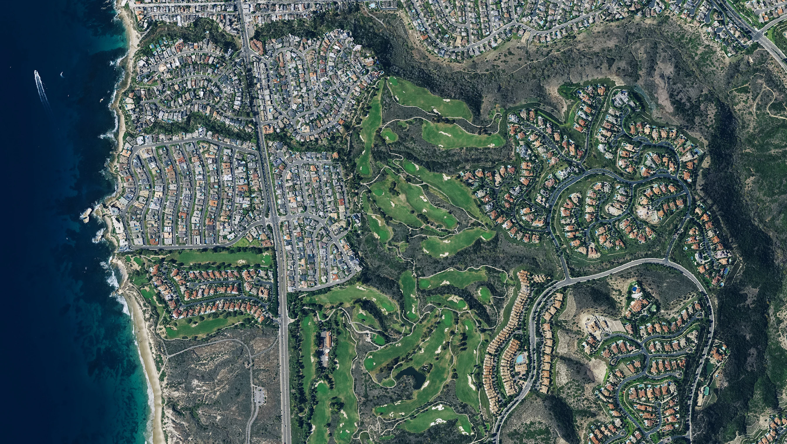
Simply put, [glossary_exclude]urban sprawl[/glossary_exclude] is the rapid expansion of cities, which creates suburbs and increasingly developed rural areas. It is usually characterized by single-use zoning, low-density residential housing, and increased reliance on individual transportation.[1]
A large problem with [glossary_exclude]urban sprawl[/glossary_exclude] stems from areas that do not serve multiple functions.[2] This is an issue for biodiversity because single-use spaces can take up land previously used as a habitat for native flora and fauna.
These spaces typically do not have long-term planning that includes biodiversity as a key value, which means it gets brushed aside.[3]
Habitat Fragmentation

As an additional factor, [glossary_exclude]urban sprawl[/glossary_exclude] pollutes environments and causes habitat fragmentation; from 1900 to 2000, more than 25% of habitats in U.S. urban regions were lost or fragmented.[5] Habitat fragmentation is the process by which large patches of native vegetation are broken into small, isolated patches. Increased urban development directly causes habitat fragmentation, since more and more land must be developed for human use.
Fragmentation vastly decreases the biodiversity in an area. This is because the fragments of land become distant, limiting movement between populations and isolating them.[6] Due to this limited movement, organisms are unable to interact with other populations to reproduce; the likelihood of inbreeding becomes higher, which causes the genetic diversity to plummet.[7] As the gene pool lessens due to inbreeding and limited reproductive options, the population becomes more vulnerable to catastrophic disturbances—all because it lacks genetic diversity.[8]
In order to address the negative effects of [glossary_exclude]urban sprawl[/glossary_exclude], Terrascope Class of 2024 is proposing a solution that utilizes wildlife corridors and the principles of urban planning. Urban planning is the development of cities through local regulations and direct interventions, providing plans for city improvement and guidelines for more city expansion.[10]
Wildlife Corridors

Wildlife corridors act as bridges between green spaces and directly address habitat fragmentation. Building wildlife corridors allows populations to be able to travel between isolated spaces, increasing their genetic diversity and the biodiversity of the spaces as a whole.[11] Additionally, a comprehensive urban planning guide will prevent future fragmentation and ensure that [glossary_exclude]urban sprawl[/glossary_exclude] does not pose a threat to local ecosystems.
Navigate through the list below to continue to read about Terrascope Class of 2024’s plan to combat [glossary_exclude]urban sprawl[/glossary_exclude].
- Environmental Impact
- Economic Feasibility
- Why It Matters
- [glossary_exclude]Why Should People Care About Urban Sprawl?
- Social Effects of Green Spaces
- Why Should Urban Sprawl Matter to Leaders?[/glossary_exclude]
- Proposed Solution Overview
- Current Legislation