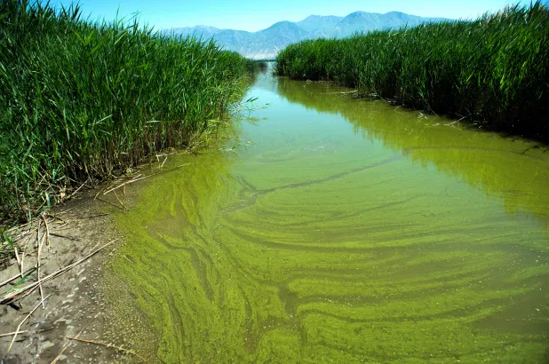
Green infrastructure solutions address two threats that cities pose to biodiversity. Cities vastly disrupt the amount of green space present, stripping the region of plants that would otherwise support pollinator species. Cities also have very little permeable surface area, meaning that, in the event of heavy rainfall, much of the water is not absorbed by the ground and therefore picks up waste from sewers and streets on its way to the waterways. This causes algal blooms in the surrounding waterways, which are explosive growths of algae that rob water ecosystems of oxygen. Further, pollution from these waterways also harm aquatic species.
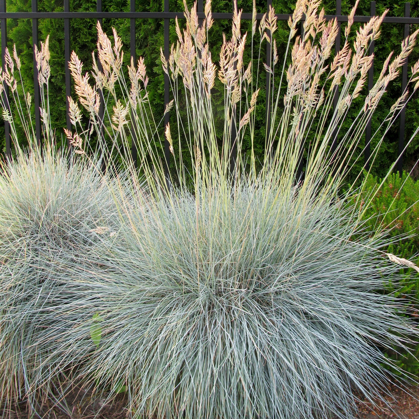
Green infrastructure addresses these problems by focusing on introducing more vegetation into a city. Plant roots are essential for preventing erosion and facilitating drainage after storms, which helps to protect aquatic species because they contribute greatly to decreasing the amount of polluted water that enters wetlands. It is estimated that, during one storm, 5 trees can absorb 200 cubic feet of water left unabsorbed by pavement.[2] Strategically selected plant species can also improve biodiversity of both flora and fauna.
Terrascope Class of 2024 offers different green infrastructure solutions for repurposing undervalued land in a city. Boston will be used as the model, so plant species and geography specific to Boston will be used as examples throughout the solution proposal, which can be found in here. Solutions ideal for the periphery, a minor part of the solution proposal, will be explained, as well as solutions devised for the center of a city, for both abandoned buildings and smaller spaces.
Brownfields

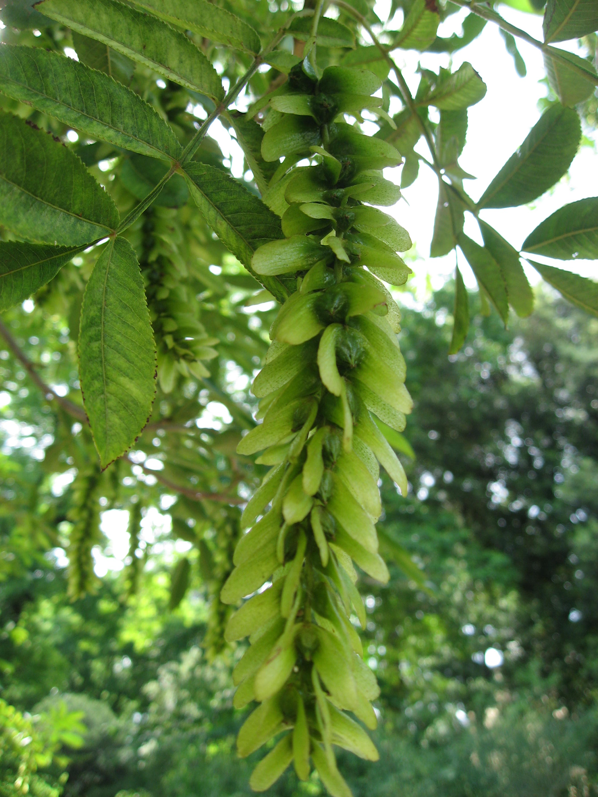
Large areas of unused land in the “periphery” of a city are usually brownfields. These are barren territories that have little potential for development or cultivation because of the high levels of contamination in the soil. One type of contamination is by heavy metals, and the plant genus Phragmites has shown potential in increasing water retention during flooding as well as in removing toxins from the soil. One study found that a minimum of 84% of metal traces in soil was absorbed in 6 weeks by these plants.[3],[4]
The current hesitation with actively deploying the solution is that this specific plant genus is generally an invasive species, but research also contends that, as long as the plant is strategically introduced, it can provide greater benefits than costs. This is because it grows in soil in which no native plants can grow.[6] The presence of vegetation is a welcome alternative to zero vegetation, and it is more likely to support an ecosystem than a brownfield is, even if the ecosystem would take on features different from that containing native flora and fauna. A potential long-term concern for using phytoremediation, however, is that the plants store the metals they absorb within themselves, becoming hazardous waste. Current solutions to these tradeoffs include incineration and composting of the harvested, toxin-absorbing plants.[7]
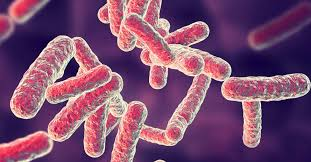
Contamination that consists of road salt buildup can be addressed by planting Artemesia vulgaris (mugwort) and Ailanthus altissima (tree-of-heaven).[8] Furthermore, grasses of the genuses Festuca, Lolium, Agropyron, Poa, Medicago, and Vicia have the potential to remove coal waste remnants like fly ash, as do microorganisms of the genuses Pseudonomas, Shewanella, and Bacillus.[9],[10]
Parks & Plants
Parks with hiking trails and a variety of plants are proposed in the flowchart. Parks are viable when there are at least 3.8 acres of land available.[13]
Tree species selected for the guidelines all consider that Boston is of the USDA Hardiness Zone 7, meaning its climate requires plants to survive a portion of the year in 0 to 10 ℉ temperature.[14]
Trees of Type 1, as defined by the Terrascope flowchart, consist of trees that remain healthier in larger living spaces and are therefore better suited to unused, abandoned sites or the periphery of a city. Type 1 species recommended for Boston include the following[15]:
- Cryptomeria japonica (Japanese cedar)
- Pterocarya stenoptera (Chinese wingnut)
Trees of Type 2 consist of trees that can be grown along streets, curbs, and other smaller, public areas. They are resilient in floods and can live in consistently wet soil. Type 2 species recommended for Boston include the following[16]:
- Ilex aquifolium (English holly)
- Nyssa aquatic (Water tupelo)
- Quercus nigra (Water oak)
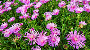
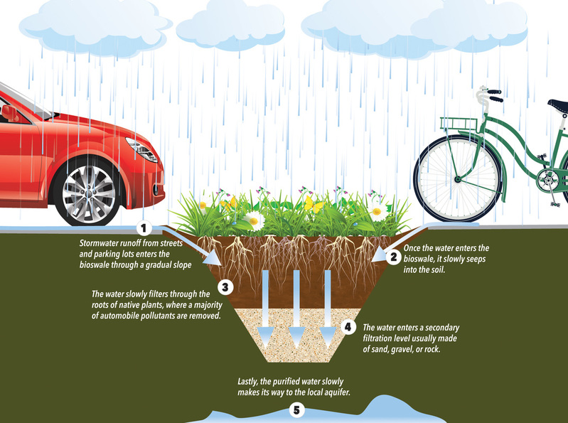
For the heart of a city, one stormwater control measure that has proven to be effective and cost efficient is rain gardens. Rain gardens absorb runoff that contains lawn and garden fertilizers, pesticides and herbicides, oil, yard waste, sediment and animal waste, which cause water pollution. These gardens increase biodiversity by using a variety of plants native to the New England region, including[18]:
- Coneflower
- Winterberry
- Crested Iris
- New England Aster
- Foamflower
- Buffalo Grass
- Great Blue
- Lobelia Little
Stormwater Management
Rain Gardens, to be effective, should take up ⅓ the area that provides the stormwater runoff, and they are ideally 2 – 4 m lower in elevation than the surrounding area[20]. If the bioswale is not deep or wide enough, it cannot absorb and direct quickly moving rainwater. Bioswales are similar to rain gardens, but are more adept at cleaning runoff by conveying them through pipes whereas rain gardens mostly absorb the water (see graphic on the right). Bioswales require more labor and materials to build as they often incorporate sand, gravel, and rocks to filter large particles out of stormwater. Plant species ideal for bioswales in Boston include[22]:
- Duck potato
- Irises
- Blue flag
- Sweet Goldenrod
- Scarlet sage
Compared to a conventional lawn, rain gardens allow for 30% more water to soak into the ground. Bioswales have shown to protect local waterways from pollutants, and in a study done by UC Davis they reduced nitrogen, phosphate, and total organic carbon loading by 99.1%, 99.5%, and 99.4%, respectively.[23] The bioswales in the study were made out of 75% lava rock and 25% loam soil.[24] The bioswales in Terrascope Class of 2024’s proposal would be designed to use sand, gravel, and other rocks, which may lower cost and potentially filtering potential. The bioswale in the study was 1 cubic meter, so Terrascope Class of 2024’s proposal plans to deploy them in the city center can be supported with similar implementation.
Abandoned Buildings
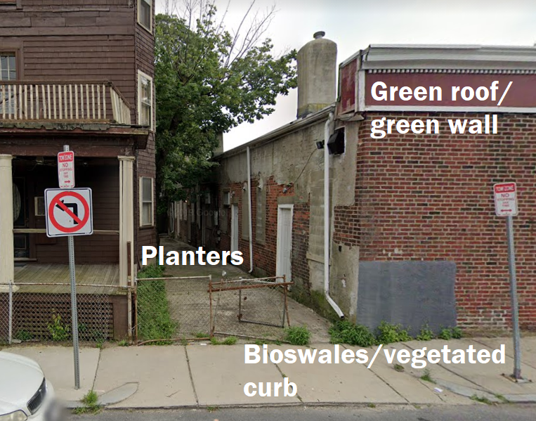
A large source of land for implementing the previously described lower-impact storm management solutions is abandoned buildings. There are over 150 identified potential sites in Boston. Demolition of these buildings can reveal space for rain gardens, bioswales, and detention ponds. Abandoned buildings in better condition can undergo a renovation of the exterior, as well, in which case planters, green walls, and green roofs may be constructed. In renovated abandoned buildings with more than 100 square feet of space, green roofs can be filled with pollinator-friendly plants such as[25]:
- Foxglove beardtongue (Penstemon digitalis)
- Wild Columbine (Aquilegia canadensis)
- Bluets (Houstonia caerulea)
- Goat’s Beard (Aruncus dioicus)
- Virginia Bluebells (Mertensia virginica)
Green roofs that support such diverse plants also double as great absorbers of water, although a drawback is that they require more maintenance when the weather is dry. Green roofs that support a variety of plants and which help store water are best implemented on top of renovated commercial buildings because of the greater load.[26] Roofs that noticeably increase water-storage are also dubbed “blue-green” roofs.
One more feature that may be integrated around abandoned buildings as the surrounding area is rebuilt or modified is permeable pavement to assist with runoff prevention. Two main types to consider are porous asphalt and pervious concrete. Porous asphalt acts as an ideal surface for driving while still allowing water to filter through it into the rock and soil layer below.[27] The City of Boston has identified porous asphalt as an ideal way of managing stormwater as well as staving off the effects of more frequent flooding that comes with climate change.[28]
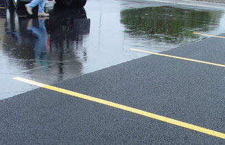
Pervious concrete has similar benefits, permitting a flow rate of 480 inches of rain/hr through it to the rock layer below.[30] While not as ideal as vegetation for directly inviting biodiversity, these alternatives to traditional paving can produce an aggregate positive effect on a city’s stormwater management efforts, protecting vulnerable aquatic species from toxin-filled runoff in the process. This solution is effective in a variety of area sizes for both recreational and functional structures, i.e. walking paths, sidewalks, plazas, parking lots, tennis courts.
Solutions at Select Sites Around Boston
The adaptive landscaping proposals put forth by Terrascope Class of 2024 are designed to be generally applicable to a city’s evolving infrastructure. As new buildings age or as new land becomes available, different parts of the solutions flowchart may apply.
To illustrate the potential of the flowchart of solutions, a few specific proof-of-concept projects are proposed. The first is a series of city center renovations that can take place with green infrastructure as the central focus. These can be completed in 20 months. The selected 5 locations for these renovations are chosen because of their proximity to existing green spaces in Boston such as the Arnold Arboretum. Their renovations can help realize the ideal of having contiguous green spaces in a city, which is more conducive to biodiversity success in urban areas than isolated pockets of green space are. The reasoning for this is discussed further in the article.
The 5 locations whose building exteriors and surroundings are proposed for renovation are:
- 21 Custer St, Jamaica Plain, MA 02130
- 5 Boynton St, Jamaica Plain, MA 02130
- 79 Jamaica St, Jamaica Plain, MA 02130
- 42 Cross St, Boston, MA 02113
- 90 Commercial Wharf, Boston, MA 02110
These properties sit on valuable plots of land in the city center. Therefore, their complete transformation into green spaces free of manmade structures is not economically feasible. However, a method for increasing their utility for humans while making them more hospitable to plants and small wildlife is choosing from the list of green infrastructure and applying them to the layout of a particular site.
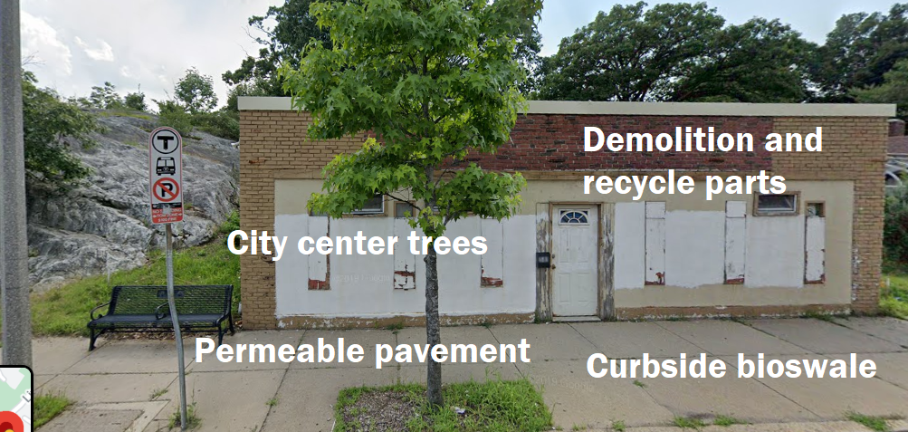
This method is demonstrated for the 5 Boynton St, Jamaica Plain property below.
This location is less than half a mile from the Arnold Arboretum, which means it contains good potential for extending contiguous green space.
Another category of buildings to consider for either demolition or renovation, depending on the results of inspection and land value estimation, are abandoned commercial buildings. The building chosen for demonstration below is of no particular importance, but it shows the potential for incorporating the previous green infrastructure solutions into a city center location.
A second specific solution proposal to be implemented is the demolition and repurposing of an old property in the Roxbury neighborhood at the address 167 Centre St, Boston, MA 02119. It fits the strictest definition of “abandoned,” certainly—vacant, tax-exempt, and unused for more than 30 years. The building itself is of little value, estimated at around $200.[33] However, the yard it occupies and the greater surrounding parking lot are estimated to be worth $1.3 million.[34]
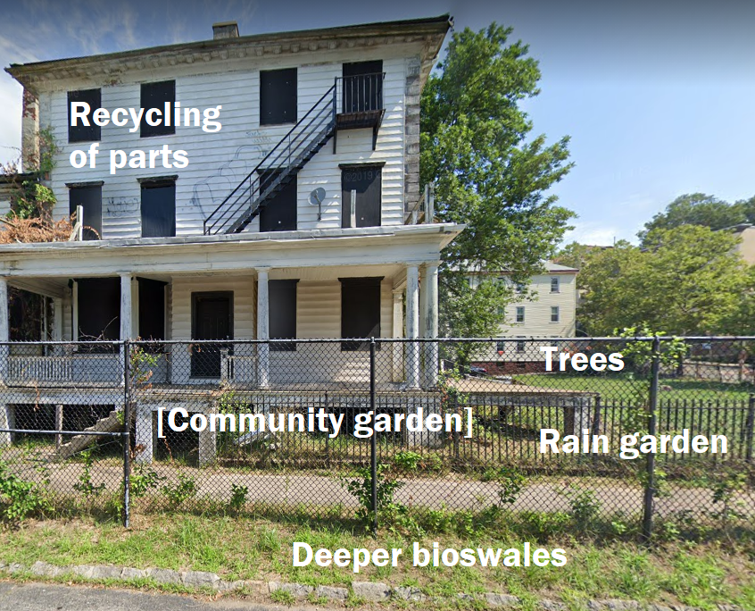
The parking lot has great potential to become green space, not being enclosed by any other commercially important buildings. To lower costs, the parking lot pavement could at least be replaced with porous asphalt or an equivalent. As for the building itself, demolition could leave the land more valuable. The curbside space can be dug out for implementing bioswales, but the main project lies within the fence. A community garden could replace the monoculture lawn and introduce more species of pollinators and plants. The simultaneous benefit would be engagement of residents in a biodiversity effort which provides them fresh produce. If the entire lot is converted, the garden could span 98,000 square feet.
The opportunity cost of such a large green space is always development of new real estate in a favorable city location, but the educational value and public opinion influence that comes with such a noticeable project are worth considering. Furthermore, the movement of a community garden into a low-income neighborhood can contribute to a solution to food insecurity. It has been shown in a Canadian study that the presence of a community garden can save one household $600 in healthcare costs related to food insecurity every year.[36] Furthermore, the first 5 years of maintaining a community garden can yield $28,000 in returns, in addition to the benefits that are less measurable.[37]
To emphasize the biodiversity element in this solution, a portion of the lot can be reserved for rain gardens, which require more space, as well as trees, which can comprise the perimeter.
Relation to Overall Proposal
Terrascope Class of 2024 has proposed these solutions through the avenue of adaptive landscaping to more evenly distribute the proposed projects throughout Boston. Not only would a more even distribution of green spaces promote equity of access to natural settings that boost mental health, it would also facilitate greater biodiversity by having more closely connected green spaces. It has been shown that greater swaths of contiguous land are more effective at nurturing pollinators and decreasing carbon emissions than separate parcels of land that aggregate a comparable area.[38]
Terrascope Class of 2024’s overall plan is to build on existing projects in Boston that are currently implementing green infrastructure to further aid in stormwater management. In 2014, Boston entered into a consent decree with the U.S. EPA and the Conservation Law Foundation to conduct three demonstration projects using green infrastructure and to fulfill other pollution mitigation requirements.[39] By taking advantage of land that is currently taken up by abandoned buildings and vacant lots, the number of yearly green infrastructure projects can be potentially doubled.
The Terrascope Class of 2024 proposal is to expand the existing green space projects undertaken by the City of Boston into Dorchester and Roxbury, finding room for such projects in the abandoned lands or otherwise devalued property in these neighborhoods. These two areas were noted as having the highest number of abandoned buildings, as shown in the graph below.
Another category of buildings to consider for either demolition or renovation, depending on the results of inspection and land value estimation, are abandoned commercial buildings.

In addition to salvaging these devalued landscapes, the Class of 2024 proposal also advocates for implementing smaller-scale solutions such as planting Type 2 trees and introducing permeable pavement in tighter city spaces that may not have the flexibility of abandoned places. Applying Dr. Berger’s 1% rule for maximizing potential within a city, the proposal combines as many disparate solutions as are relevant so that pockets of green space may be implemented wherever possible, whether at the site of abandoned buildings or onto a tight curbside space.